
Table of Contents
About Abiqua Falls
- Length: 0.7 miles out-and-back from the trailhead (longer if you parked further up the road)
- Difficulty: Moderately Challenging
- Parking Pass: None Required
- Pet Friendly: Yes, but I would not recommend bringing your pups due to the steepness and difficulty
- Restrooms: No
- Service: No (save our instructions before you go!)
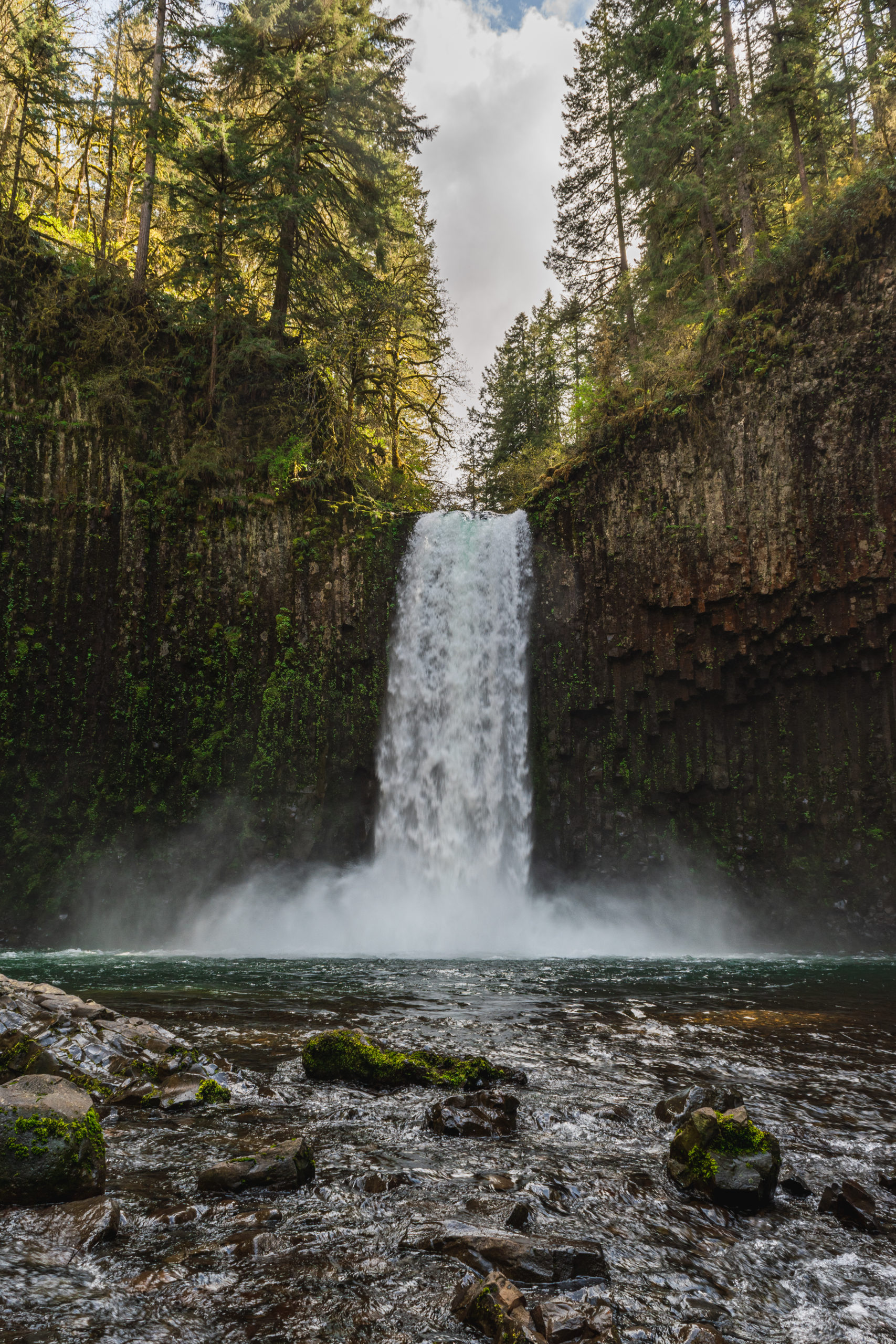
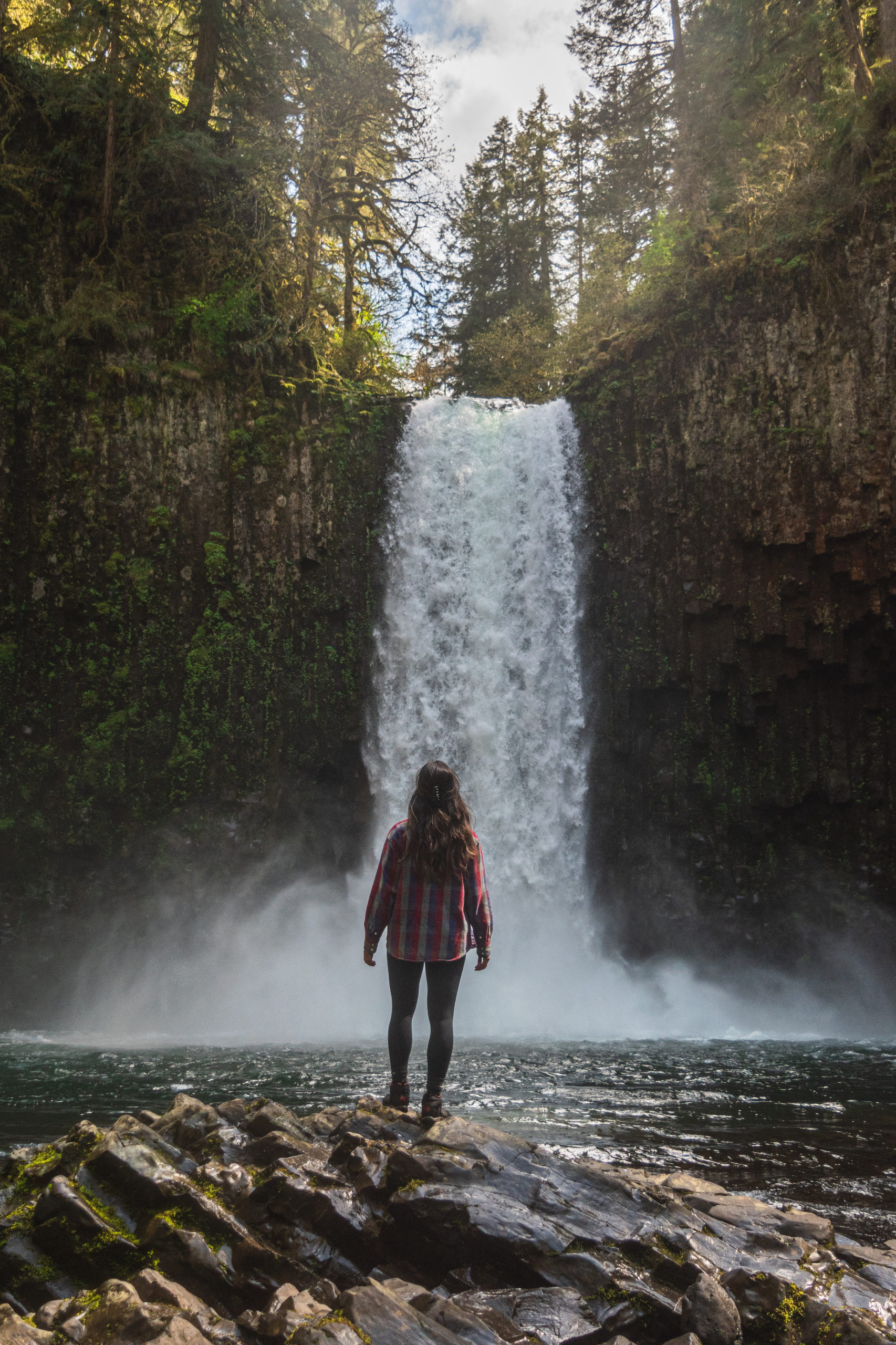
Abiqua Falls is one of Oregon’s many beautiful waterfalls. The 92-foot waterfall cascades down a gorgeous wall of basalt columns surrounded by a lush, green forest. This hidden gem is located a little over an hour southeast of Portland near the town of Scott Mills. It’s located on private property, but the falls remain open for recreational use. Nearby you can also find Silver Falls State Park, famous for it’s Trail of 10 Falls.
Although Abiqua Falls is a lesser known destination, but it can get crowded, especially during the hot summer months. One important note about Abiqua – it can be daunting to drive all the way down to the trailhead, and also to trek from the trailhead to the creek that leads to the falls (more on that later). Also, there is little to no signage on the way down to the trailhead. The hike itself is only a 0.7 mile out-and-back, however if you park at the top parking lot it adds a fairly steep 2 miles each way but avoids harsh road conditions.
What to Bring
The trail down to the creek that winds up to the waterfall is very steep and can be muddy, making it easy to slip. I would highly recommend wearing hiking boots with good traction and clothes that you won’t mind getting muddy. Unfortunately, I left my sandals at home, but I would definitely recommend bringing them to use once you get to the waterfall (my hiking boots got soaked). And of course, you should always bring plenty of water and snacks!
Getting to the Trailhead
Parking will be the first hurdle when visiting Abiqua Falls. If you are coming from Portland, you will pass through Scott Mills and continue driving on Crooked Finger Road. This will eventually turn into a gravel road and a little over a mile in, take a right (this road will take you to the Abiqua Falls trailhead).
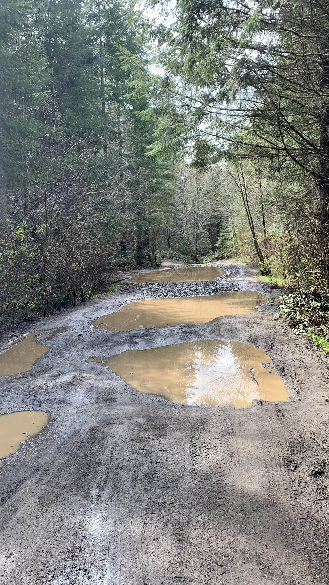
Driving to the trailhead from here can be quite challenging, but you have a few options. Having attempted this hike years ago I remembered how rough and rocky the road is, with a lot of potholes. The road also gets quite narrow and uneven at some sections. If you have a high clearance vehicle you will have an easier drive down to the end of the road where the trailhead is. Keep in mind if it’s a warmer day it may be busy, and with the end of the road only having enough room for a dozen or so cars to park you could find yourself turning back around to find a spot. Luckily there are a number of spots along the road wide enough for you to pull off and park.
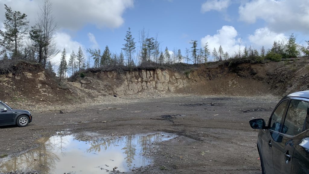
I didn’t want to risk it in my Nissan Rogue so we immediately parked at the first open area off to the right – this is officially known as the Abiqua Falls parking lot and has the most space to park. From here, we had a 2 mile descent to the trailhead. Looking back, we could have continued a little bit farther down the road and parked closer to the trailhead, but we didn’t mind the extra cardio on such a beautiful spring day.
Getting to the Falls
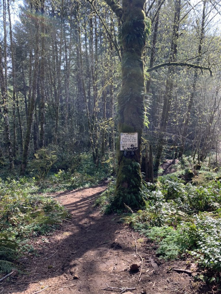
The trailhead is not clearly marked… like at all. When we made it to the end of the road there was a white arm gate and no sign of the trailhead.
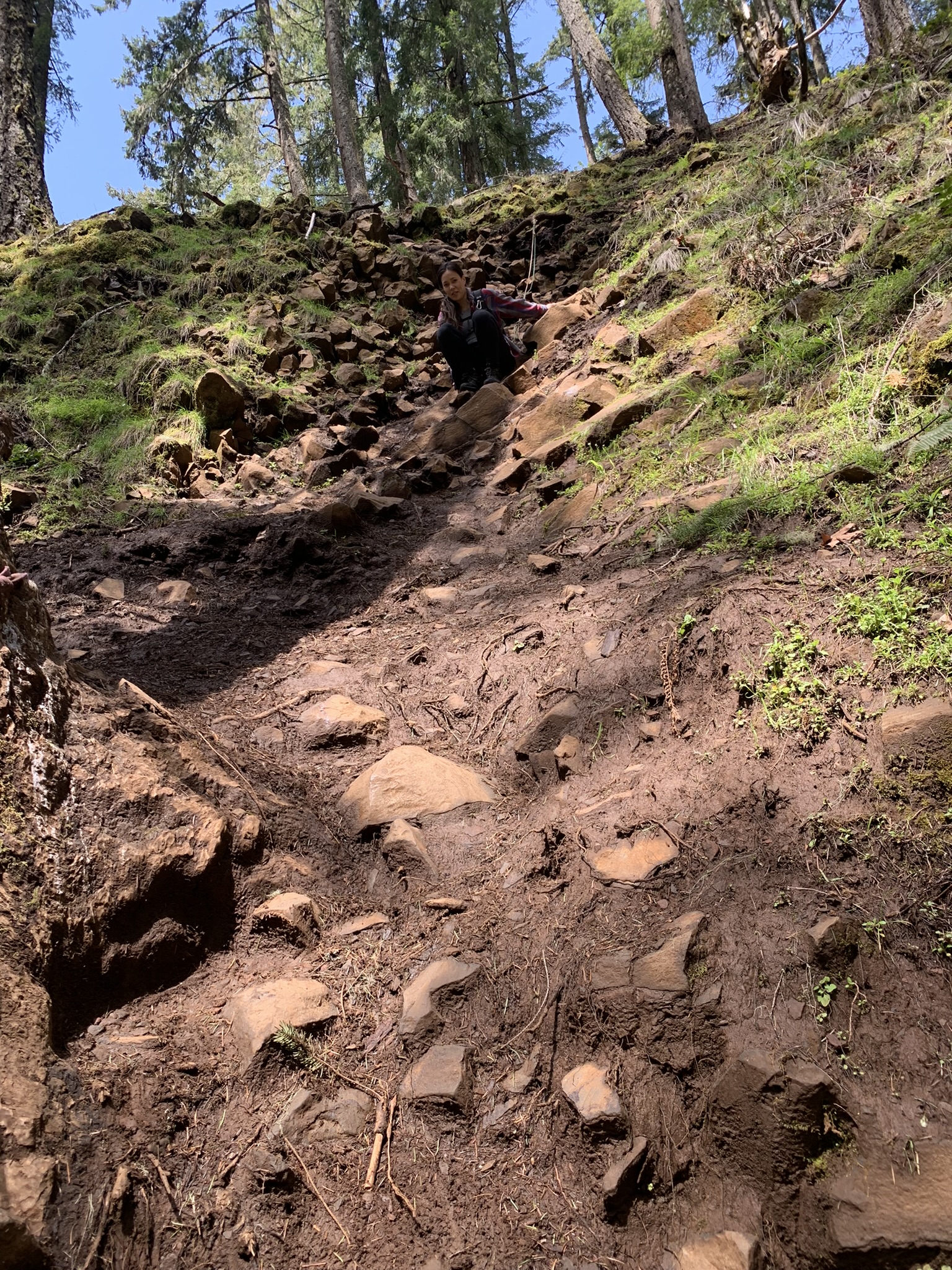
You’ll want to look for a path on your left that has a white sign on a tree, just before you get to the parking area at the end of the road. This is the trail you want to take! Once you’re on this path, follow it down and make sure to stay towards the left. This is the less steep route and is highly recommended! This route still has a section that can be difficult for some, but there are several ropes along the way to help you down.
Unfortunately, we followed the trail to the right, which I definitely do NOT recommend (especially if you are afraid of heights like me). While this section still had ropes to help you down, there were sections that didn’t have any ropes. The loose rocks, and soft, slippery mud made me feel like I was going to slide all the way down.
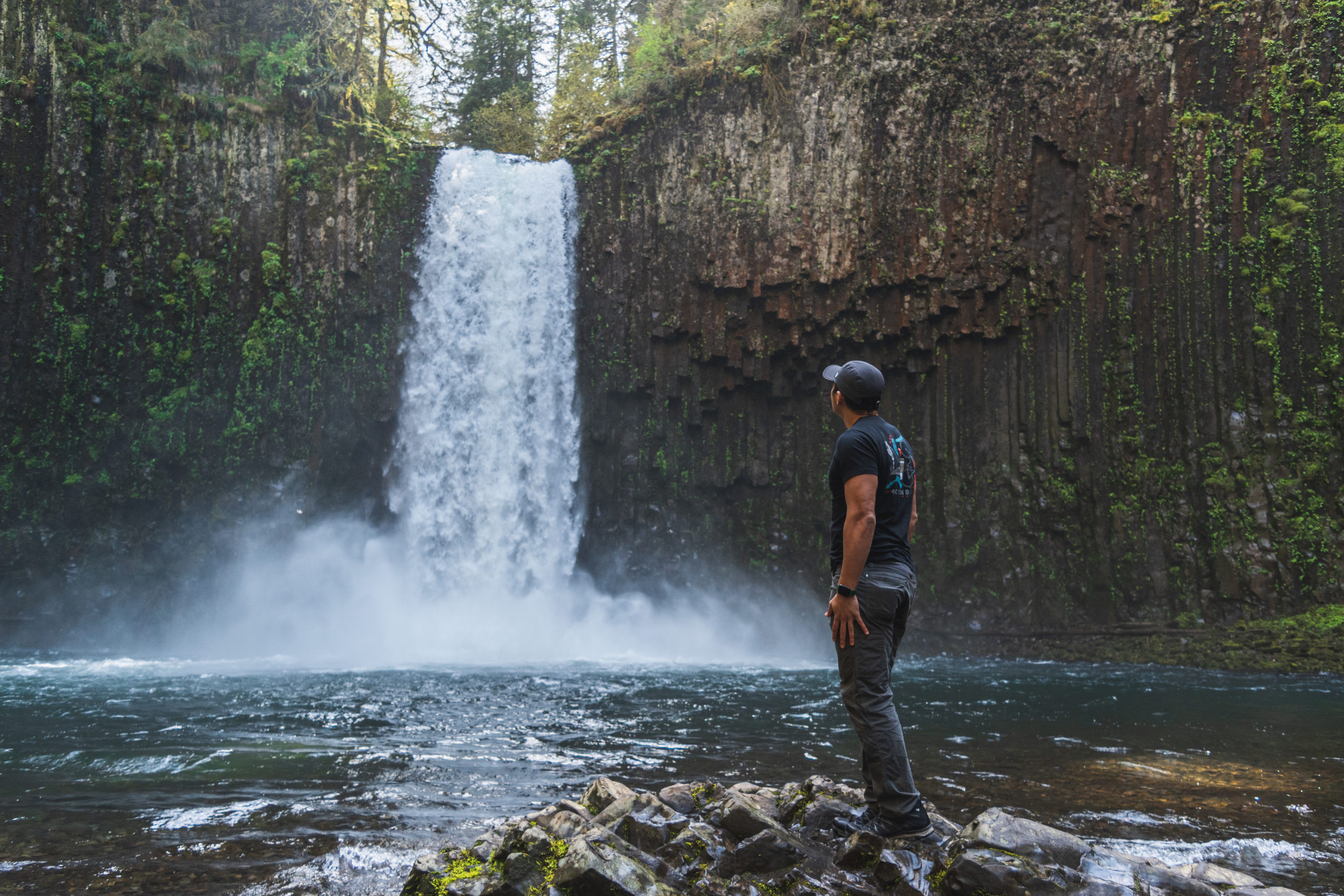
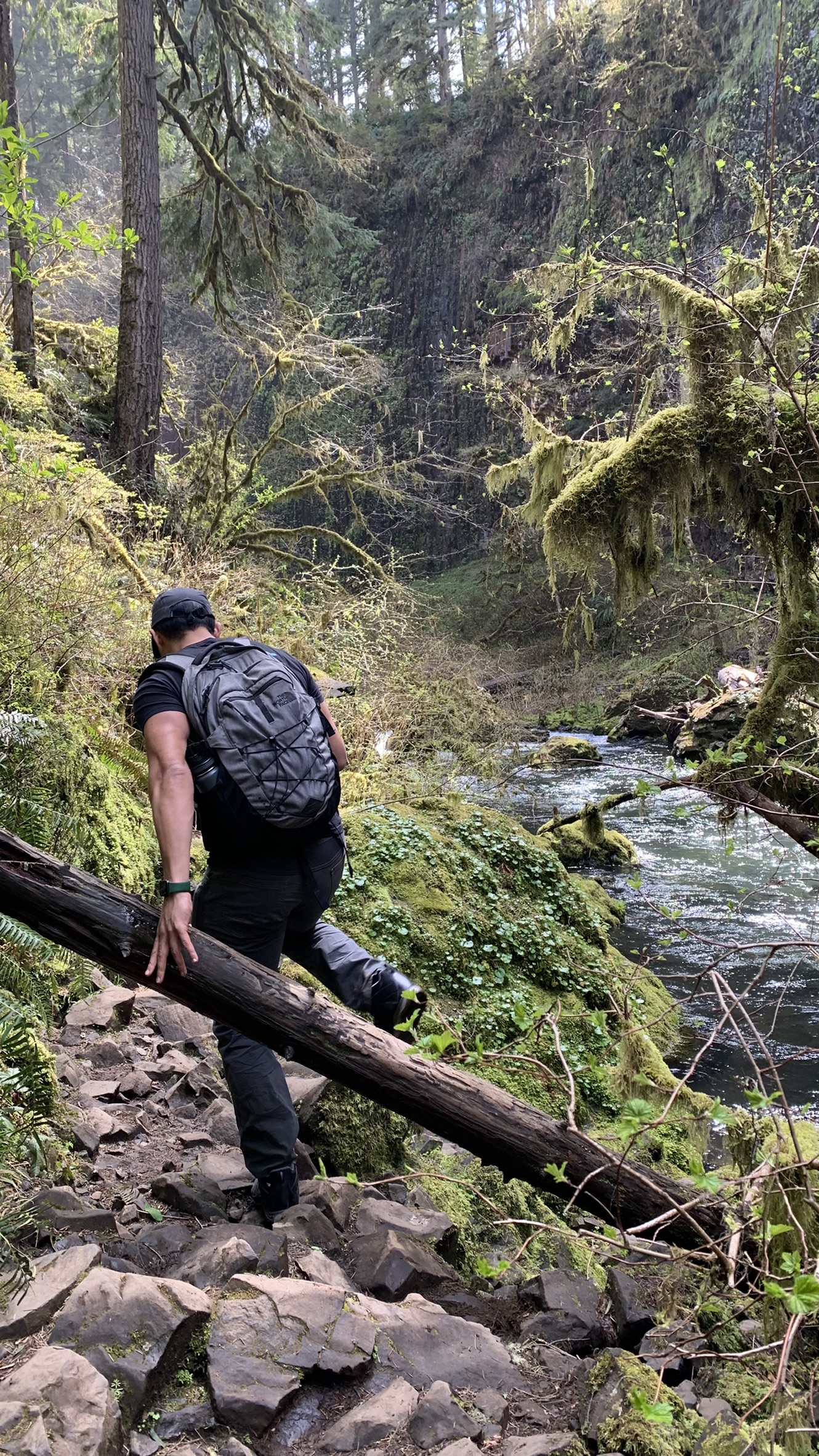
Once you get to the bottom of the steep section, take a left and follow this trail along the creek. As you get closer, you’ll be able to hear the sounds of rushing water. Eventually, after rounding a corner, you will arrive at the beautiful Abiqua Falls.
We stayed for about an hour to admire the beauty and force of Abiqua Falls. After taking a few photos and having a snack, we made our way back to the top. This time we learned our lesson, and took the less steep route back up. Then from the trailhead, we continued uphill for another 2 miles to make it back to the “parking lot” where our car was.
Let us know if you decide to explore Abiqua Falls! Getting there can be quite the journey, but it’s definitely worth it! And as always, make sure to respect the land, and pack up any food or trash you brought in with you.
Happy hiking!

Thanks for your blog, nice to read. Do not stop.